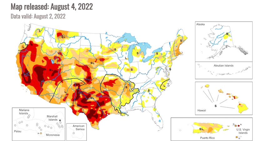
The latest map from the U.S. Drought Monitor shows vast areas of the Western, Southwestern, and Central U.S. in dark red and bright red, representing exceptional drought and extreme drought.

The latest map from the U.S. Drought Monitor shows vast areas of the Western, Southwestern, and Central U.S. in dark red and bright red, representing exceptional drought and extreme drought.